For this final post of 2020, I was looking back through recent projects for something interesting yet brief; I’ve been writing some encyclopedia-length posts lately and wanted to keep this one on the lighter side. In that vein, I’ve decided to share a short list of free web mapping services that I use as basemaps in QGIS (they’ll work in ArcGIS too). This has been on my mind as I’ve recently stumbled upon the OpenTopoMap, which is an alternate stylized version of the OpenStreetMap that looks pretty sharp.
See this earlier post for details, but in short, to connect to these services in QGIS:

- Select the appropriate web map service type in the browser panel (usually WMS / WMTS or XYZ Tiles), right click, and add new connection.
- Give it a meaningful name, paste the appropriate URL into the URL box, click OK.
- In the browser panel drill down to see the service, and for WMS / WMTS layers you can drill down further to see specific layers you can add.
- Select the layer and drag it into the window, or select, right click, and add the layer to the project.
- If the resolution looks off, right click on a blank area of the toolbar and check the Tile Scale Panel. Use this to adjust the zoom for the web map. If the scale bar is greyed out you’ll need to set the map window to the same CRS as the map service: select the layer in the panel, right click, and choose set CRS – set project CRS from layer.
- Some web layers may render slowly if you’re zoomed out to the full extent, or even not at all if they contain many features or are super detailed. Conversely, some layers may not render if you’re zoomed too far in, as tiles may not be available at that resolution. Experiment!
If you’re an ArcGIS user see these concise instructions for adding various tile layers. This isn’t something that I’ve ever done, as ArcGIS already has a number of accessible basemaps that you can add.
In the list below, links for the service name take you to either the website version of the service, or to a list of additional layers that you can connect to. The URLs that follow are the actual connections to the service that you’ll use within your GIS package. If you use OSM, OTP, or Stamen in your maps, make sure to cite them (they use Creative Commons Licenses – follow links to their websites for details). The government sources are public domain, but you should still cite them anyway. Happy mapping, and happy holidays!
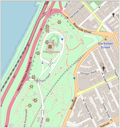
OpenStreetMap XYZ Tile (global)
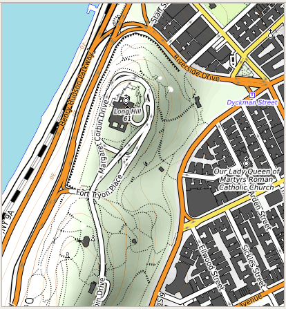
http://tile.openstreetmap.org/{z}/{x}/{y}.pngOpenTopoMap XYZ Tile (global)
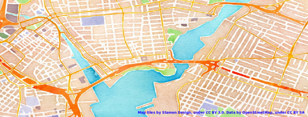
https://tile.opentopomap.org/{z}/{x}/{y}.pngStamen XYZ Tile (global) see their website for examples; the image topping this post is from watercolor
http://tile.stamen.com/terrain/{z}/{x}/{y}.pnghttp://tile.stamen.com/toner/{z}/{x}/{y}.pnghttp://tile.stamen.com/watercolor/{z}/{x}/{y}.jpgUSGS National Map WMTS (global, but fine detail is US only)
Imagery:
https://basemap.nationalmap.gov/arcgis/rest/services/USGSImageryOnly/MapServer/WMTS/1.0.0/WMTSCapabilities.xml

Imagery & Topo:
https://basemap.nationalmap.gov/arcgis/rest/services/USGSImageryTopo/MapServer/WMTS/1.0.0/WMTSCapabilities.xml

Shaded Relief:
https://basemap.nationalmap.gov/arcgis/rest/services/USGSShadedReliefOnly/MapServer/WMTS/1.0.0/WMTSCapabilities.xml

Topographic:
https://basemap.nationalmap.gov/arcgis/rest/services/USGSTopo/MapServer/WMTS/1.0.0/WMTSCapabilities.xml
US Census Bureau TIGERweb WMS (US only) see their website for older vintages
Current TIGER features:
https://tigerweb.geo.census.gov/arcgis/services/TIGERweb/tigerWMS_Current/MapServer/WMSServer

Current physical features:
https://tigerweb.geo.census.gov/arcgis/services/TIGERweb/tigerWMS_PhysicalFeatures/MapServer/WMSServer