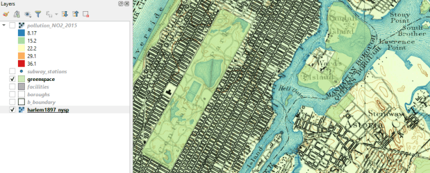
I recently released an updated version of the manual and data I use for my day-long GIS Practicum, Introduction to GIS Using Open Source Software (Using QGIS). The manual has five chapters: a summary overview of GIS, basics of using the QGIS interface, GIS analysis that includes several geoprocessing and analysis functions, thematic mapping and map layout, and a summary of where to find data and resources for learning more. Chapters 2, 3, and 4 are broken down into sections with clear steps, followed by commentary that explains what we did and why. We cover much of the material in a single day, although you can space the lessons out into two days if desired.
I updated this version to move us from QGIS 2.18 Las Palmas to 3.4 Madeira, which are the former and current long term service releases. While the move from 2.x to 3.x involved a major rewrite of the code base (see the change log for details), most of the basics remain the same. While veteran users can easily navigate through the differences, it can be a stumbling block for new users if they are trying to learn a new version using an old tutorial with screens and tools that are slightly different. So it was time for an update!
My goal for this edition was to keep my examples in place but revise the steps based on changes in the interface. Most of the screenshots are new, and the substantive changes include: using the Data Manager for adding layers rather than the toolbar with tons of buttons, better support for xlsx and ods files which allowed me to de-emphasize xls and dbf files for attribute table joins, the addition of geopackages to the vector data mix, the loss of the Open Layers plugin and my revision to the web mapping section using OSM XYZ tiles, the disappearance of the setting that allowed you to disable on the fly projection, and the discontinuation of the stand-alone Data Browser. There were also changes to some tools (fixed distance and variable buffer tools are now united under one tool) and names of menus (Style menu has once again become the Symbology menu).
It’s hard to believe that this is my ninth edition of this tutorial. I try to update it once a year to keep in sync with the latest long term release, but fell a bit behind this year. QGIS 2.18 also survived for a bit longer than other releases, as the earlier 3.x versions went through lots of testing before ending up at 3.4. When it comes time for my tenth edition I may change the thematic mapping example in chapter 4 to something that’s global instead of US national, and in doing streamline the content. We’ll see if I have some time this summer.
Since I’m in update mode, I also fixed several links on the Resources page to cure creeping link rot.

