At These Coordinates
Dispatches from the Geospatial Data World
Menu
About
Resources
QGIS Tutorial
Census Book
Publications
Search for:
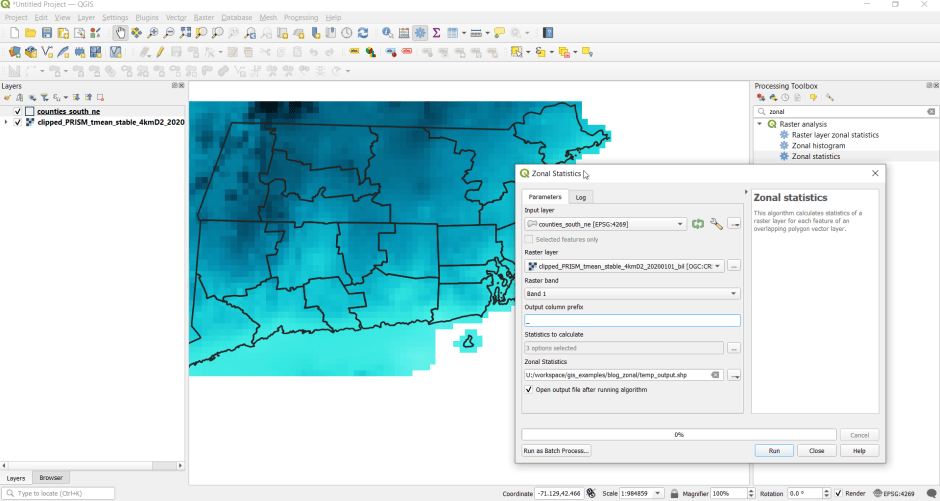
QGIS Zonal Stats
←
Previous
Next
→
Leave a comment
Cancel reply
Comment
Subscribe
Subscribed
At These Coordinates
Join 38 other subscribers
Sign me up
Already have a WordPress.com account?
Log in now.
At These Coordinates
Subscribe
Subscribed
Sign up
Log in
Copy shortlink
Report this content
View post in Reader
Manage subscriptions
Collapse this bar